The past few weeks in our lectures we have been exploring contouring, areas and cut & fill.
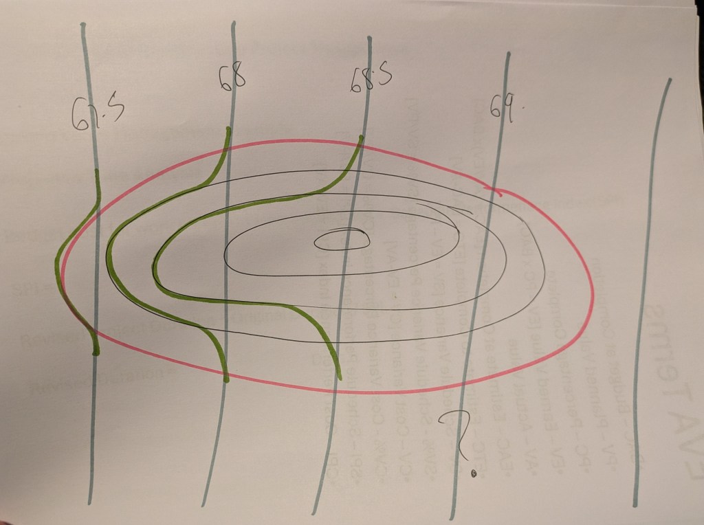
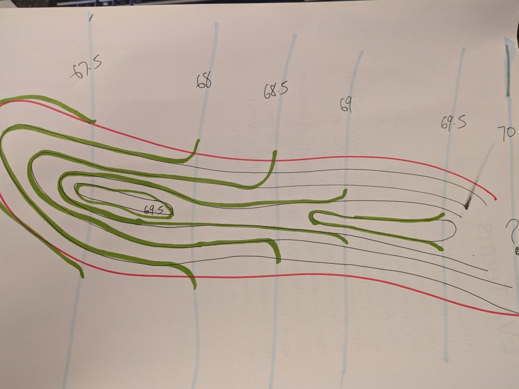
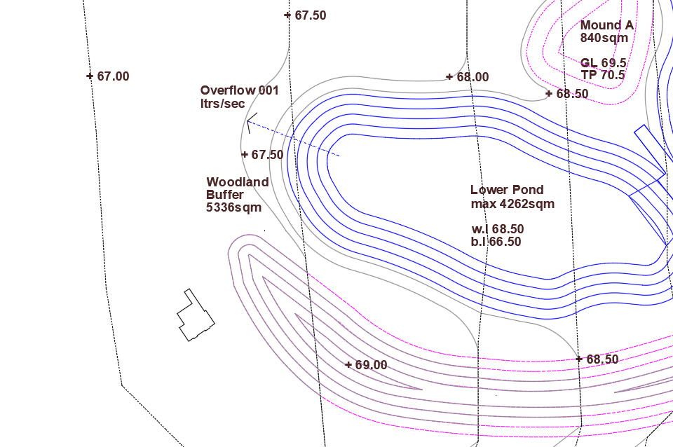
This involves a bit of maths and a earth movements. We have been instructed to regrade and alter the 0.5m contours to a max gradient of 1/3.
Here are some examples of my workings. I am still struggling with, for example contour 69 in the left picture, which contour regrade line does that take. and when you get to the top of your mound our bottom on the pond, where do the contours go then, when your contour is cutting through the space still.
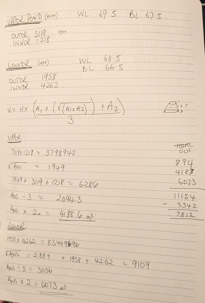
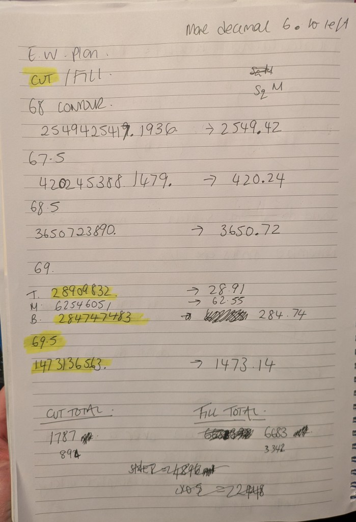
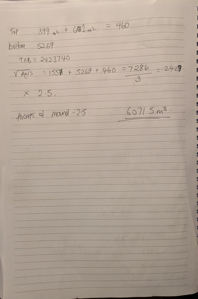
The mound hight is determined from the cut volume of regrading and excavating of the ponds. I found the maths quite simple, and finding it much easier to do the maths step than using BODMASS technique on the calculator.
Here are my calculations to determine the volume left and then how much will be used for the mound, determining the height.
Maybe prematurely I have adapted my DWG file, and to me it all works until I get across to the mid point of the mound where I lose my contours. A further tutorial is in order!

Leave a comment