When creating the setting out plan I encountered several technical challenges related to the points and the coordinate annotation.
I found out, after having laid all of my points initially that the formatting must be finalised before copying the points across the drawing. Any changes made after duplication required manual updates to each individual point. So I had to redo them to ensure they were legible.
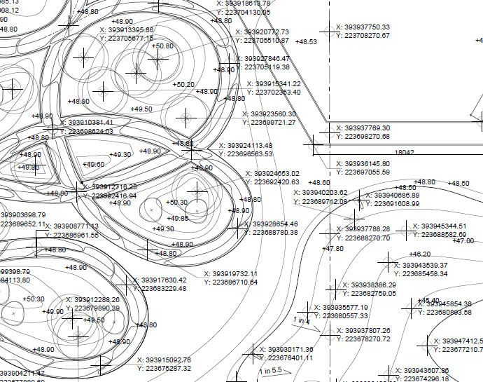
There was also a persistent problem with units. Although the drawing units were set to metres, the coordinates were being shown in millimetres and no matter who I asked or what I did I couldn’t change them. The only viable workaround would have been to manually adjust each coordinate value, something that wasn’t feasible given the amount of points I had. In the end, I kept the coordinates in millimetres. While technically accurate, I don’t think it would be best practice.
My the design added another layer of challenge. Some areas were so intricate that placing the coordinate labels without overlap became a bit of a puzzle. I ended up using leader lines to keep everything readable and just hoped that they were clear enough for a contractor to decipher without issue.
I also felt that the drawing could have benefited from more dimensions, but I was constantly balancing legibility with clarity. Adding more would have made the sheet overwhelmingly busy, possibly doing more harm than good.

Leave a comment